
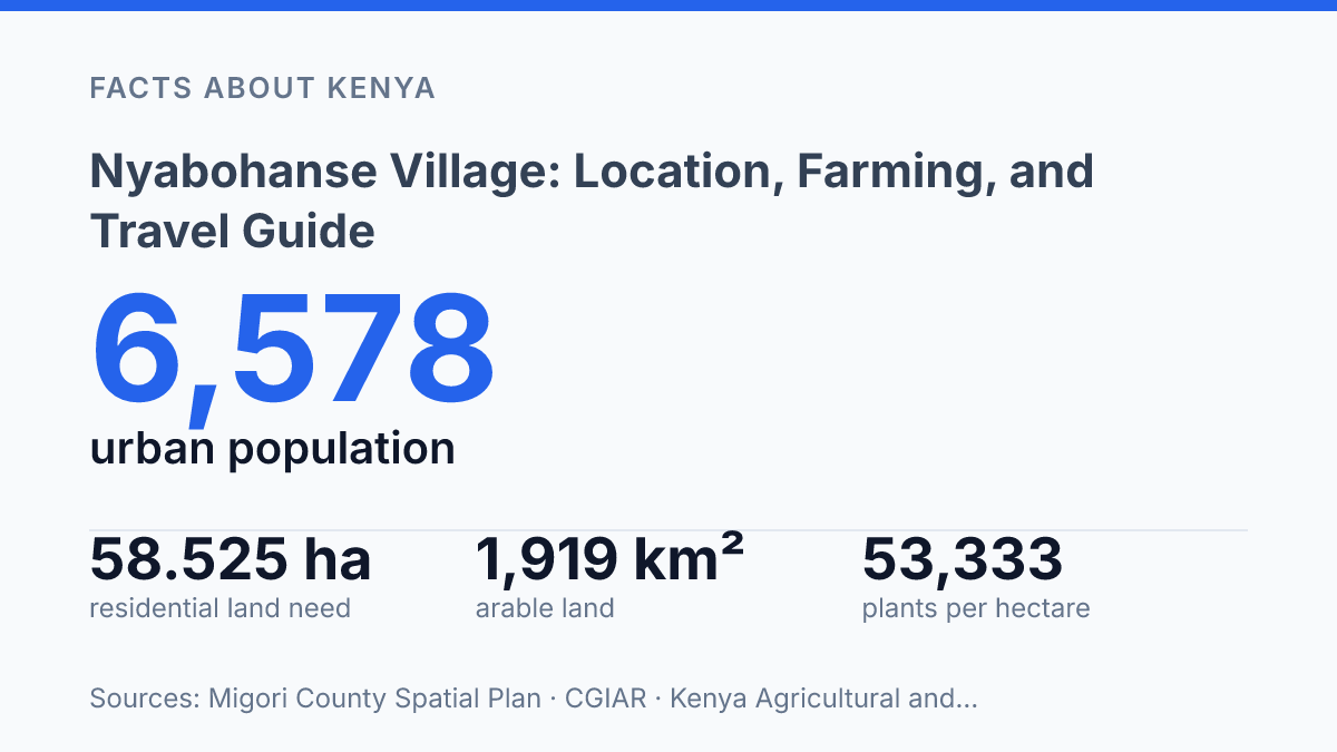
Nyabohanse village is not just a dot north of Isebania. County planners project its urban population to reach 9,364 by 2030.
That number matters. It turns a quiet border-area settlement at about 1.20957°S, 34.4719°E into a place where land, roads, crops, and household choices start pressing against each other. The village sits roughly 3.5 km north of Isebania, close enough to the Kenya-Tanzania border to feel connected, but still shaped by local farms and county roads.
This guide keeps the focus practical. You’ll see how to reach the area from Nairobi or Kisumu, why rainfall and markets shape daily life, and how farmers use spacing, acreage, and seed rates to make better field decisions. In my view, the numbers tell a sharper story than any travel label could.
Where Nyabohanse sits in Migori County
Nyabohanse can feel tucked away. It sits only 3.5 km north of Isebania, a border-area town tied closely to movement between Kenya and Tanzania. According to Mapcarta/OpenStreetMap (2026), Nyabohanse is located at about 1.20957°S, 34.4719°E in Migori County, near Isebania and Sirari.
That pin matters. It places the village in western Kenya, not as an isolated dot, but as part of a practical cross-border zone.
The closest major reference point is Migori town. For travelers, it gives the village a clearer mental address.
For residents, it connects rural production to shops, services, buyers, and county offices. Nyabohanse may not have the pull of a large town, but proximity to Migori town gives farmers and traders a place to sell, source supplies, and handle errands that can’t be solved within the village.
Warm tropical weather shapes the rhythm of daily life here. County climate data places Migori’s temperatures around 24–31°C, with annual rainfall ranging from 700 to 1,800 mm. Those figures explain why farming dominates local routines.
People plan work around heat, rain, planting windows. The condition of the soil after showers.
That climate is generous. It isn’t effortless. Rain supports crops and grazing.
It also decides when fields can be prepared and when footpaths become difficult. A short dry spell can slow planting. A heavy spell can interrupt market days. In my view, the weather is the quiet force behind almost every practical choice in the village.
What makes the setting sharper is the contrast. Nyabohanse village has a rural feel, with farms and local social networks at its core.
But its nearness to the Tanzanian border gives it value beyond its size. Goods, people, and ideas move through border areas faster than maps suggest… and that gives this small settlement more practical weight than a first glance reveals.
How to get there from Nairobi and Kisumu
The fastest route begins in the air. The least predictable part comes after you reach Migori town.
Farming, rainfall, and local market life
A sack of maize here can represent food security one month and school-fee money the next. Most residents farm. The two crops that anchor daily planning are maize and cassava, with other food crops fitting around household land, seed access, and expected weather.
Rain sets the calendar more firmly than any printed schedule. Farmers watch the season closely before opening fields, buying seed, or committing family labour. That same rain makes income less predictable than outsiders expect… a good start can still turn into a difficult harvest if showers break at the wrong time.
Cassava matters because it gives households a buffer when maize is uncertain. It can stay in the ground longer, so families don’t have to sell or consume everything at once.
Maize brings faster cash when yields are good. It also asks for sharper timing.
County support shows how organized farming has become beyond individual plots. On March 20, 2024, according to the Kenya News Agency, Migori County distributed maize, bean, sorghum, and rice seed to 16,470 farmers, covering thousands of acres across the county.
That kind of input program doesn’t remove risk. It shows why seed access is a serious economic issue, not a side concern.
Local markets keep the farm economy moving in small, practical steps. Produce leaves through traders, neighbours, and regular market days, and cash returns as school money, food purchases, transport fares, or the next round of farm inputs.
This isn’t market life staged for visitors. It’s the daily machinery of survival.
Community farming groups add another layer of order. They help farmers share labour, pool information, arrange seed or fertilizer purchases, and sometimes negotiate sales with more confidence than one household can manage alone. In my honest opinion, that’s the part that deserves more attention: the village economy doesn’t run only on rainfall and soil, but on trust, timing, and people organizing before the season tests them.
How farmers use simple math in the field
A farmer who measures one side of a square plot can turn a guess into a seed budget in under a minute. The shortcut is A = s²: area equals side length multiplied by itself. If a square garden has a 20-metre side, the plot is 400 square metres.
That number matters before anyone opens a seed packet. Once the area is known, the farmer can match it to crop spacing and estimate how many planting holes the plot can hold. A small error on paper can become a real cost in the field.
Spacing turns the area into a plan. For example, KALRO gives maize spacing guidance of 75 cm by 25 cm, and its 2024 recommendation says that pattern gives 53,333 plants per hectare with one plant per hill.
A farmer doesn’t need to memorize the full hectare figure to benefit from it. They can scale the idea down to their own plot.
The method is simple, but that’s the point. When input cash is tight, buying too many seeds ties up money that could go to transport, fertiliser, or labour. Buying too few creates gaps in the field and weakens the harvest before the season has really started.
In my humble opinion, this kind of field math deserves more respect because it protects small decisions from becoming expensive mistakes. It also makes spacing less random. The farmer can walk into the market with a rough count, not just hope and a sack.
What changes when a village starts needing more land
By 2030, the hard question won’t be whether the village can grow. It will be whether families, traders, and farmers can measure that growth before it prices them out.
The Migori County Spatial Plan puts the coming residential need at 58.525 hectares, but land on paper never behaves like land under crops. A plot can be a home site, a maize field, a shop frontage, or a family’s only safety net. That tension is the story to watch.
Before you visit, invest, or farm here, bring two tools: a route plan and a notebook. Count distances.
Ask prices. Check rainfall timing. In my honest opinion, the people who pay attention early will understand this place before it changes shape.
Frequently Asked Questions
Q: Where is Nyabohanse village located in Kenya?
A: Nyabohanse village is in Migori County, in western Kenya near the Tanzanian border. That location shapes daily life there, from trade to travel. Kenya is the country, western is the region, and border is the big geographic clue.
Q: What do people in Nyabohanse village do for a living?
A: Most residents are farmers. Maize and cassava are the main crops, and community farming groups play a real role in helping people work together. In my humble opinion, that cooperative side matters as much as the crops themselves.
Q: What is the weather like in Nyabohanse village?
A: The area has warm, tropical weather. That helps crops grow. It also means farmers have to pay close attention to rainfall. warm and tropical are the two words that describe it best, and seasonal rainfall decides a lot.
Q: How do I get to Nyabohanse village from Nairobi?
A: The usual route is to fly from Jomo Kenyatta International Airport to Kisumu International Airport. From Kisumu, it’s about a 3-hour matatu ride south on the B1 highway to Migori town, then a local taxi or matatu east to the village. That last leg is the one people underestimate.
Q: Why do farmers in Nyabohanse village use simple math for planting?
A: They use basic formulas to plan crop spacing and seed purchases. For a square garden plot, they use A = s² to find the area, then figure out how many seeds they need. 2024 is not the key number here; A = s² is, and 3-hour travel time shows how practical the whole routine is.