
Geographical features of Kenya can split rainfall in half: during the 2024 long rains, Central Kenya and the Great Rift Valley topped 200% of normal rainfall. The coast stayed below 90%. That contrast is the point.
Kenya isn’t a neat climb from beach to peak. It is a country cut open by a north-south valley, lifted into cool highlands, and edged by reefs that blunt ocean force before waves reach shore.
The map keeps changing too. Rift lakes are pushing past old shorelines. Mount Kenya still carries ice, but only as remnants high above tarns and moorland.
In my honest opinion, the real story is not scenery. It’s pressure. Landforms steer rain, trade, farming, wildlife, and risk.
Read the country this way. The coast, valleys, and peaks stop looking separate. They start acting like one system.
How Kenya’s position shapes its main landforms
The most misleading shorthand for Kenya is “savanna,” since the country’s shape is controlled less by one habitat than by altitude, moisture. A hard east–west tilt in the land. Kenya straddles the equator.
That doesn’t make its terrain evenly tropical. The north–south contrast is sharp, with wetter highland belts breaking away from hotter, drier country farther north and east.
Its eastern edge is fixed by the Indian Ocean, where a shoreline of about 536 km gives Kenya a narrow low coastal front before the land rises inland. That coastal strip is low, warm, and humid. It sets up one end of the national profile: sea-level plains first, then rising ground, then interior plateaus and highlands.
The Kenya Yearbook Editorial Board places the Great Rift Valley running north–south through Kenya at an average elevation of about 1,500 metres, splitting highlands to the west from lower country to the east. That single line helps explain why a map of Kenya can look simple.
The ground does not behave simply. Elevation changes temperature, rainfall, farming potential, and settlement patterns in a short distance.
Central Kenya forms the high, cooler core. The highlands catch more moisture and support denser cultivation than the dry plains around them.
During the March–May 2024 long rains, Central Kenya and the Rift Valley received more than 200% of their long-term rainfall average, according to the Kenya Meteorological Department. The coast stayed below 90% of normal.
That contrast is the point. The obvious story says Kenya is mostly open grassland. The real structure is more divided and more dramatic. In my view, the country makes the most sense when you read it as a climb from ocean edge to highland spine, then a fall into drier northern and eastern zones.
The coast, reefs, and lowland plains
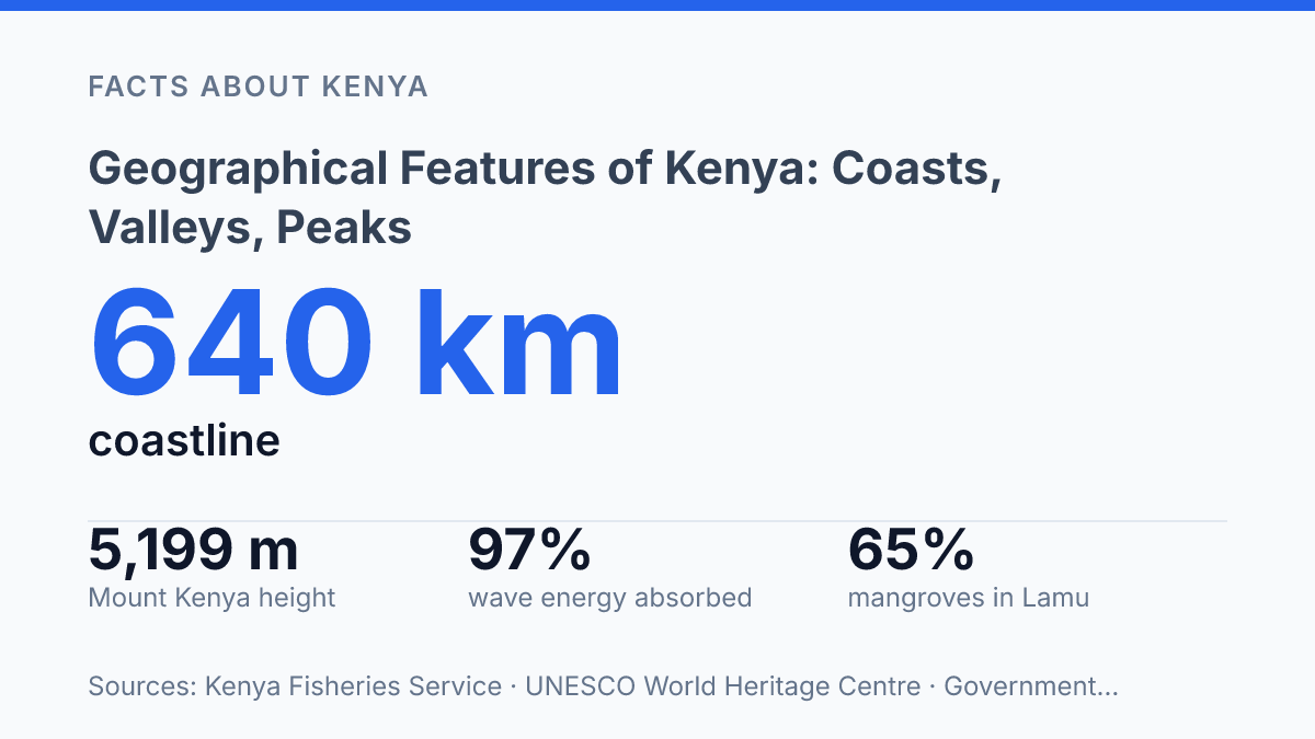
Reefs off Kenya’s shore can absorb up to 97% of incoming wave energy. The coast’s first line of defence is alive, not concrete. That fact changes how you read the shoreline.
It isn’t just sand beside the Indian Ocean. It’s a working marine edge shaped by coral, tides, creek systems, and soft lowland ground.
Mombasa gives that edge its strongest economic weight. It is Kenya’s main coastal city and the country’s key seaport, so ships, warehouses, roads, and rail links crowd into a landform that already has little room to spare.
The harbour matters far beyond the coast. That strength comes with pressure on wetlands, nearshore water quality, and old creek environments.
Coral reefs run along parts of the coast, with mangrove zones rooted in sheltered creeks and estuaries. Government of Kenya and UN SDG platform data list 250 coral species and 9 mangrove species in the marine zone, along with more than 600 fish species. Those numbers show a coast that works as habitat, storm buffer, and food source at the same time.
The apparent simplicity is misleading. The land looks flat and easy to read, but it’s where salt water, reefs, mangroves, and port traffic meet in a fragile strip of land. In my honest opinion, that tension is the most important thing to understand about Kenya’s coast.
Behind the shore, the coastal plain stays narrow and low before the land begins its inland rise toward the higher country. This transition matters because it compresses settlement, farming, transport, and marine ecosystems into a thin zone.
There’s no endless flat belt here. The terrain changes character quickly once you move away from the ocean.
Recent reef monitoring adds another layer. In 2024, surveys across four marine protected areas found mean hard-coral cover above 41%, according to the Wildlife Research and Training Institute. Yet the figures varied sharply from site to site, which is the point: the coast may appear continuous on a map, but its reefs and lowlands don’t behave as one uniform system.
Why the Great Rift Valley changes everything
Kenya’s sharpest inland contrasts come from a scar, not a mountain range. The Great Rift Valley runs through Kenya as a chain of dropped floors and raised margins. That break creates a long escarpment system, with steep walls, sudden viewpoints, and floor-level basins that feel much lower than the country around them.
Look past the views and the valley becomes more forceful. Faulting did not just split the ground. It tilted blocks, redirected drainage, and left basins where water could collect instead of escaping easily.
Volcanic activity added another layer: cones, ash-rich soils, lava fields, hot springs, and geothermal zones. This is why the Rift reads less like a scenic corridor and more like an engine of physical change.
Lake Naivasha and Lake Nakuru show that engine at work. Naivasha is a freshwater lake set in a basin where inflow, groundwater, and local relief shape its character. Nakuru is shallower and alkaline, with a chemistry tied to closed-basin conditions.
They sit close enough to seem like siblings. They don’t behave the same way.
The surprise is that this wound in the ground also made some of Kenya’s most productive and distinctive lake basins. Broken terrain can sound barren, but Rift floors and margins can hold fertile volcanic soils, water, pasture, and settlement. In my humble opinion, the valley matters most where it controls water, soil, and movement, not where it photographs well.
Recent lake change makes the point sharper. Lake Baringo expanded from 128.08 km² in 2010 to 268.06 km² in 2020, according to Kenya’s Ministry of Water. That is more than double its earlier area in a decade.
The figure doesn’t mean every Rift lake is rising in the same way. It proves these basins are active physical systems, not fixed blue patches on a map.
You can read the valley as a fracture, a lake belt, or a volcanic zone. The better reading is all three at once. Faults made the frame.
Volcanoes reshaped the floor. Water filled the low points and turned broken ground into some of Kenya’s most distinctive inland geography.
Mount Kenya and the central highlands
Kenya’s highest point rises from farm country, not from an empty alpine wilderness. Mount Kenya reaches 5,199 meters, making it the country’s highest peak and the dominant feature of the central highlands. Its upper slopes look severe: black volcanic rock, thin air, alpine moorland, and summits that can still appear snow-capped even near the equator.
That cold image hides the bigger story. The mountain’s flanks and nearby uplands have long been among Kenya’s most productive and settled areas, not a remote edge of national life. In my view, that contrast is the key to understanding why this region matters.
Altitude changes the rules here. Cooler air reduces evaporation, and rising terrain helps wring moisture from passing air masses.
That makes the central highlands far better suited to intensive farming than many surrounding lowlands. Tea, coffee, maize, vegetables, and dairy all draw strength from this high-country climate.
The shift can feel abrupt. Move away from the uplands and the air warms, rainfall becomes less dependable, and farming starts to look more exposed to dry spells. The highlands don’t remove risk.
They soften it. That’s why population and cultivation cluster so strongly around these cooler slopes.
Mount Kenya is also a volcanic archive. According to the UNESCO World Heritage Centre, it was active roughly 3.1–2.6 million years ago and may once have stood much higher than it does now. Erosion carved down the old volcano, leaving jagged peaks, glacial tarns, and 12 remnant glaciers near the summit zone.
The snow is real. It shouldn’t be romanticized. These ice remnants are small, exposed, and sensitive to warming.
They give the mountain its iconic look. The more lasting force is lower down: water, soils, slope, and cool air feeding one of Kenya’s core agricultural regions.
What the map is already warning Kenya about
The next useful question isn’t where Kenya’s landforms are. It’s what they will force people to adjust first.
A reef that absorbs 97% of wave energy is not decoration. It is public infrastructure.
A lake edge in Baringo that moved after 2010 is not a minor map correction. It changes farms, roads, schools, and memory.
The hard part is that Kenya’s geography gives and takes at the same time. Highland rain feeds rivers, but floods can erase a season.
Coastal ecosystems support jobs. They need space to survive.
In my humble opinion, the smartest way to read this country is as a living set of limits. Ignore those limits. The map will redraw the lesson for you.
Frequently Asked Questions
Q: What are the main geographical features of Kenya?
A: Kenya’s main features run from the Indian Ocean coast to the Great Rift Valley and up to Mount Kenya in the central highlands. The country is split by the equator. You get sharp contrasts in climate and terrain across one country. In my view, that contrast is the whole story, and it’s what makes Kenya stand out.
Q: Does Kenya have both mountains and beaches?
A: Yes. That mix is one of the country’s biggest draws. You can move from tropical coastline with coral reefs to the snow-capped volcanic peak of Mount Kenya, which rises to 5,199 meters. That’s a huge swing in elevation. It changes everything from weather to travel plans.
Q: Where is the Great Rift Valley in Kenya?
A: The Great Rift Valley cuts through Kenya as a dramatic trench across the country. It sits between the coast and the central highlands, and it’s one of the clearest signs of how powerful Kenya’s geology really is. The contrast with the surrounding plains is striking.
Q: What makes the Kenyan coast different from the rest of the country?
A: The coast has a tropical Indian Ocean climate, coral reefs. A much warmer feel than the inland areas. That’s a big shift from the arid plains and highland zones you see farther inland. If you’re planning a trip, that difference matters more than people expect.
Q: How high is Mount Kenya, and why does it matter?
A: Mount Kenya reaches 5,199 meters, making it the country’s highest peak. It matters because it anchors the central highlands and creates a sharp contrast with the lowlands and Rift Valley around it. That elevation also helps explain Kenya’s range of climates in a very small space.