
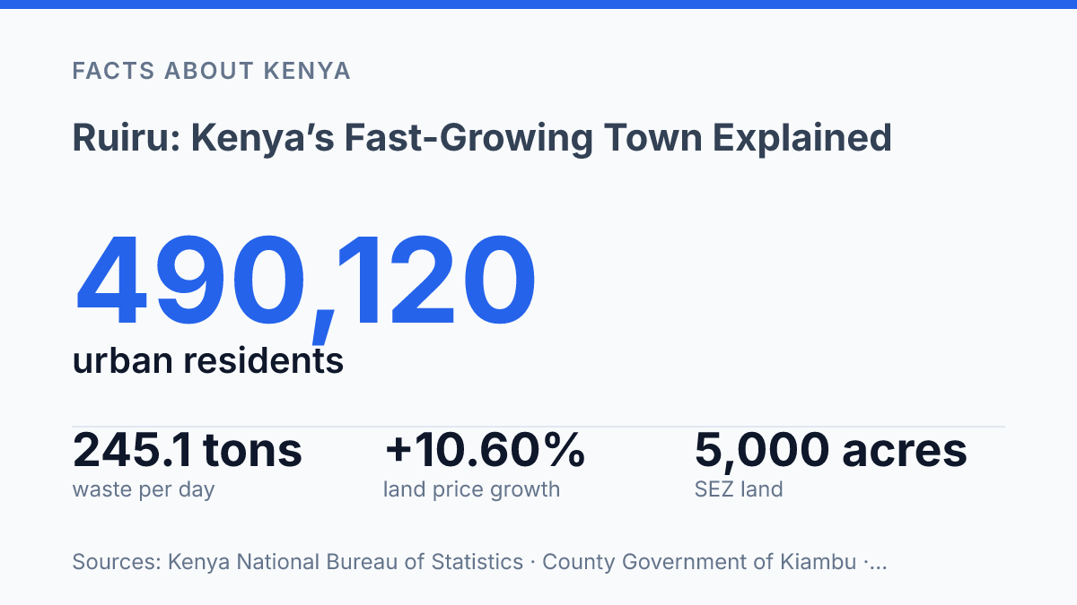
Ruiru was listed by KNBS at 490,120 people in 2019, a figure that put it behind only Nairobi City, Mombasa and Nakuru in Kenya’s urban-centre table.
But that headline number also created confusion. The town can be read as a 201.36 sq km administrative municipality, a Kiambu sub-county, or an urban centre spilling toward Nairobi and Thika.
This guide treats that confusion as the point, not a footnote. In my honest opinion, that’s the only honest way to explain why land prices jumped 10.60% year-on-year in HassConsult’s Q1 2026 index, why Tatu City’s industrial zone matters, and why everyday services now feel the strain.
You’ll get the geography, the census trap, the growth engines. The practical details that shape a first visit or a move.
Where Ruiru sits in Kiambu County
A town just 21 km from Nairobi’s centre can shape the capital’s commute more than places with bigger names. Ruiru is both a municipality and a sub-county in Kiambu County, Kenya, sitting on the northern edge of the capital’s urban reach. That position puts it inside the greater Nairobi Metropolitan region, not outside Nairobi’s orbit in any practical sense.
A 2024 planning document from the County Government of Kiambu gives the municipal footprint as 201.36 km², places it 21 km from Nairobi city centre and 17 km from Thika, and lists Juja, Githunguri, Kiambu, Nairobi and Machakos as its borders, with Gitothua, Biashara and Gatong’ora as its wards. Those details matter. They show a town tied to several local economies at once, rather than one neat administrative box.
On paper, it reads like a satellite town. In daily life, that label feels too small. Its proximity to Nairobi gives it far more weight than its size suggests, especially for people moving between home, factories, offices, colleges and markets.
The strongest link is movement. Thika Road connects the town to Nairobi and Thika, so commuters and goods don’t have to pass through a remote rural edge before reaching the capital. Nearby bypass routes also pull traffic toward Kiambu, Machakos and the wider metropolitan ring.
That access is useful. It comes with pressure.
A location this close to Nairobi attracts housing, business parks, logistics yards and daily commuter traffic. In my view, calling it a dormitory town misses the point. Its geography makes it a working part of Nairobi’s economy, not just a place where Nairobi workers sleep.
Why the 2019 census changed how people read the town
A town ranking just behind Nairobi City, Mombasa and Nakuru forced planners to stop treating the place as a commuter fringe. In the 2019 Kenya Population and Housing Census, the Kenya National Bureau of Statistics ranked Ruiru as Kenya’s 4th largest urban centre by population, with 490,120 people. That placed it ahead of heavyweight towns such as Eldoret and Kisumu in the urban-centre table, according to KNBS.
That ranking changed the conversation. Nakuru had long carried the profile of a major urban hub.
Eldoret and Kisumu also had stronger national name recognition. The surprise was that this Kiambu town had grown large enough to sit in the same national bracket, not as a footnote, but as a population centre demanding the same seriousness in planning.
The number matters most when you translate it into daily pressure. More residents mean more rental demand, more subdivision of land, and faster apartment construction.
That creates opportunity for developers and landlords. It also raises the cost of entry for households that arrived looking for cheaper space.
Roads feel the change first. A higher population rank means more school runs, delivery vans, matatus, private cars, and service vehicles competing for the same local routes. Even small junctions become stress points when growth outruns design.
Schools and public services face the same squeeze. Classrooms fill faster.
Clinics serve a larger catchment. Water, drainage, waste collection, street lighting, and security all have to scale from town-level provision to city-style demand. In my honest opinion, the census ranking matters because it exposed the gap between how large the town had become and how slowly local systems tend to adjust.
A high rank is good news for investors, job seekers, and property owners. But it is also a warning.
Population size brings market power. It also punishes weak planning quickly.
What drives Ruiru’s growth
Land values tell the story faster than cranes: according to HassConsult’s Q1 2026 Land Price Index, the town posted 10.60% annual growth, the strongest among Nairobi satellite towns. That kind of rise doesn’t come from hype alone. It points to real pressure from buyers, landlords, schools, shops and employers all chasing the same ground.
Spillover from Nairobi is the first engine. Households that work or trade in the capital use the municipality as a commuter base, especially when they want more space than inner-city rents allow. The tradeoff is sharp: the same access that makes settlement practical also raises plot prices and turns the morning trip into a daily test.
The Thika Road corridor gives that demand a spine. It shortens the mental distance between home, office, campus and market, so developers can sell apartments and gated estates to people who still depend on Nairobi incomes.
But a corridor is not a cure-all. When too many trips follow the same timetable, better access can still feel slow.
Employment has changed the equation too. Tatu City says its special economic zone has 5,000 acres of development-ready land, more than 100 operating industrial firms and over 25,000 jobs created so far. That pulls demand from both sides: workers need nearby housing, and suppliers want premises close to factories.
Residential growth then attracts everyday commerce. Estates around Kamakis, Membley and the Tatu City side support supermarkets, eateries, pharmacies, petrol stations and service yards.
Retail follows rooftops. Landlords know a dense estate can feed a strip of shops faster than a standalone office park.
Education facilities add a quieter but steady driver. Zetech University and schools around newer estates bring students, staff, rental demand and weekend spending. In my humble opinion, this matters more than outsiders notice, since a campus or school doesn’t just fill classrooms. It creates a local economy around transport, food, printing, hostels and security.
What visitors and new residents should know
The easiest mistake newcomers make is assuming Nairobi proximity means Nairobi-style services. The town is close enough for work, study, supply runs, and client meetings in the capital, but daily life runs on a different urban rhythm.
You feel that in queues, estate access roads, drainage gaps after heavy rain. The way small errands can take longer than the map suggests.
Commuting is practical, not effortless. Many residents build their day around peak-hour movement, fare changes, school runs. The reliability of the first and last mile from their estate.
The convenience is real. It comes with planning.
Density is now a daily experience, not just a planning figure. Kiambu County’s development plan projects sub-county density to reach 2,179 persons per square kilometre by 2027, which means apartments, maisonettes, gated courts, kiosks, schools, clinics, churches, garages, and offices sit closer together than many first-time residents expect.
That closeness helps with access. It raises the stakes for parking, water storage, waste pickup, and quiet.
The municipality’s 2024 Solid Waste Management Plan estimates 245.1 tons of solid waste per day, with residential sources producing the bulk of it. That number tells you something practical: growth isn’t just visible in buildings.
It shows up in collection schedules, informal dumping risks. The cost of keeping neighbourhoods liveable.
Business activity doesn’t sit apart from housing here. Ground floors turn into salons, pharmacies, eateries, hardware shops, M-Pesa agents, repair yards, and mini-markets.
That mix gives residents convenience on foot. It also means noise, delivery traffic, signage, and competition for frontage.
Inside Kenya’s urban network, the town matters because it absorbs people, firms, and services that the capital can’t hold comfortably. It links homes, employment, logistics, retail, and county-level services in one expanding urban node. In my view, its real significance is not that it looks like a smaller Nairobi. It’s that it shows how Kenya’s next layer of urban growth actually works.
Why growth here needs a sharper checklist
The sharper question now is not whether the town will keep expanding. It is who can live well with the tradeoffs. By 2027, Kiambu expects density in the sub-county to reach 2,179 persons per km², and growth at that pace exposes every weak service fast.
Before you buy land, rent a flat, or set up a business, check access roads at peak hour, waste collection, water reliability, and nearby zoning. Ruiru Municipality’s own waste plan puts daily solid waste at 245.1 tons, with 76% coming from homes. In my humble opinion, that number matters more than another glossy estate billboard.
Growth rewards people who read the fine print. The town’s next chapter won’t be decided by distance from Nairobi, but by how well ambition survives contact with ordinary infrastructure.
Frequently Asked Questions
Q: Why is Ruiru growing so fast?
A: Ruiru is pulling in residents because it sits inside the greater Nairobi Metropolitan region and offers easier access to jobs in and around the city. That mix matters. The growth also brings pressure on roads, housing, and services. In my view, that’s the real story behind the town’s rise.
Q: Is Ruiru a town or a municipality?
A: Ruiru is a municipality and a sub-county in Kiambu County, Kenya. That matters because the area isn’t just a settlement on the map. It has an official local government structure. People usually call it a town. The administrative label is broader.
Q: How big is Ruiru compared with other towns in Kenya?
A: According to the 2019 national population census, Ruiru was the 4th largest urban centre in Kenya by population. That ranking tells you how quickly it has changed, but size alone doesn’t explain the full picture. The pace of expansion is what catches most people off guard.
Q: Where exactly is Ruiru located?
A: Ruiru is in Kiambu County, Kenya. It sits within the greater Nairobi Metropolitan region. That location is a big reason it keeps drawing people in. You’re close to Nairobi. You don’t have to live in the middle of it.
Q: Is Ruiru part of Nairobi?
A: No, Ruiru is not part of Nairobi County. It is its own municipality in Kiambu County, though it functions like a commuter town for many people working in Nairobi. That’s the tension here: separate administration, but tightly linked daily life.