
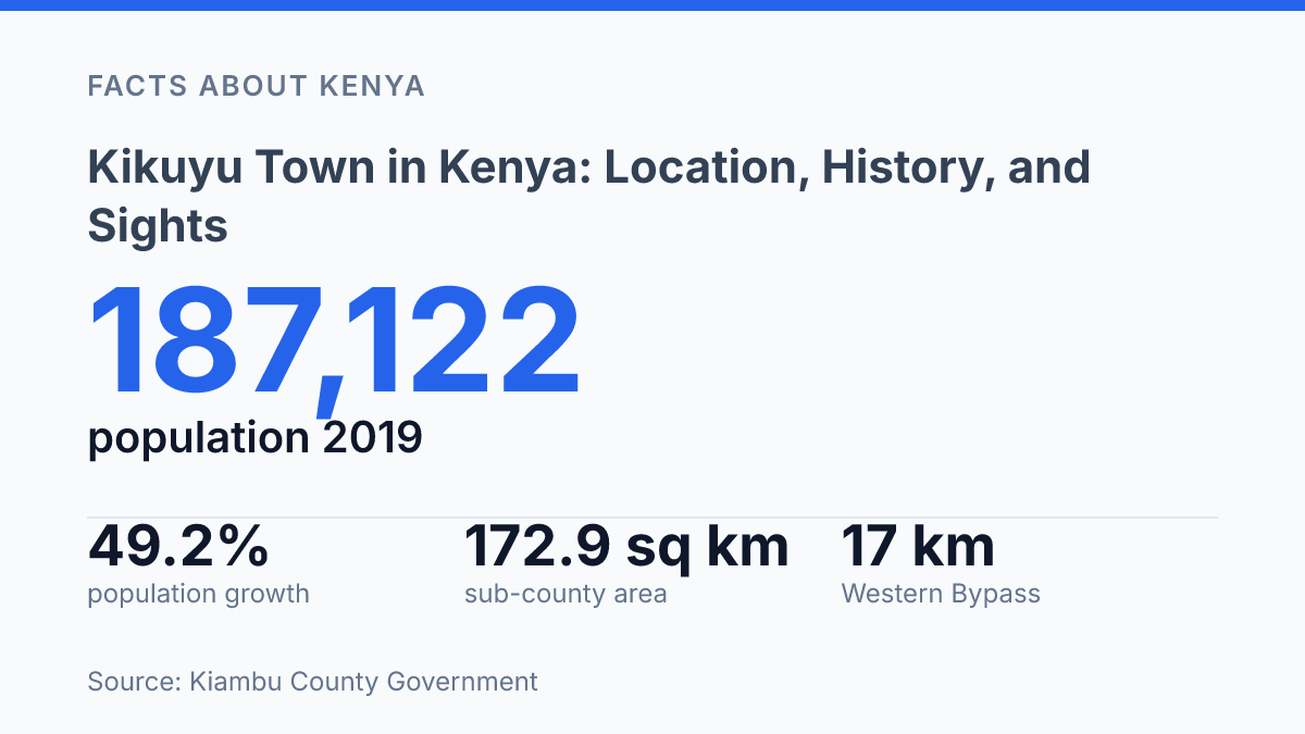
Kikuyu packed a 49.2% population jump into the decade from 2009 to 2019. It still covers just 172.9 sq km on the edge of Kiambu County. That contrast matters.
A place this compact shouldn’t carry so much history, commuter pressure, wetland debate, and road investment. This one does.
About 20 km northwest of central Nairobi, the town sits inside one of Kiambu’s 12 sub-counties and anchors a planning area split across five wards. The railway arrived in 1899.
One year earlier, Rev. Thomas Watson had already secured about 30 acres for a mission station, setting up the school-hospital-chapel sequence that shaped the settlement.
This guide follows the town as a real place, not a pin dropped beside Nairobi: its administrative shape, mission roots, nearby sights. The redevelopment now pulling the CBD, roads, and Ondiri area into sharper focus. In my honest opinion, the best way to understand it is to look at what feels ordinary first, then notice how much is changing underneath.
Where Kikuyu sits in Kiambu County
A distance of just 20 km from central Nairobi puts this Kiambu County town in the awkward sweet spot: close enough for a daily commute, but far enough to keep its own pace. Kikuyu is in Kiambu County, Kenya, northwest of the capital. That position explains why people read it in two ways at once.
It looks like a Nairobi satellite town. It doesn’t behave like a swallowed suburb.
The commuter logic is straightforward. The town sits along Nairobi’s outer residential belt, where people can live outside the capital and still reach work, school, hospitals, and business appointments without treating the trip as a full-day journey. The A109 Nairobi–Nakuru road gives it the main practical link for daily movement, with the Southern Bypass and Western Bypass strengthening that pull toward the wider metro area.
Administrative boundaries make the place bigger than the town centre suggests. In the county’s 2025 planning framework, the Kiambu County Government identifies the sub-county as one of 12 in Kiambu, covering 172.9 sq km and divided into five wards: Karai, Nachu, Sigona, Kikuyu and Kinoo. That matters.
You’re not just dealing with a roadside town. You’re looking at a wider local area with rural edges, expanding estates, and fast-changing transport pressure.
Its location also makes it a western gateway into Nairobi’s metropolitan edge. From here, movement fans toward Westlands, Karen, Ngong, Limuru. The Nakuru corridor.
That is useful. It comes with a tradeoff. Better access brings more housing demand and heavier traffic. In my view, the town’s real identity comes from that tension, not from its closeness to the capital alone.
How a mission settlement became a town
A university now stands in the shadow of a mission claim that began with just 30 acres. According to Paukwa, Rev. Thomas Watson had settled here by 1898 and secured land for a mission station.
That was the town’s starting point: not a market first, not an administrative camp first. A mission settlement with religion at its centre.
The Presbyterian presence gave the settlement its first durable institutions. A school opened in 1907, followed by a mission hospital in 1908 and a chapel in 1909, according to Paukwa. Those dates matter because they show how growth took root through services people needed every week, not through a single government decree.
Church-linked institutions did more than serve worshippers. They created routines, drew families, trained young people, and gave the settlement a civic spine. In my honest opinion, that institutional inheritance is the real reason the town’s origin story still feels visible rather than buried.
The sharp contrast is that one of its most modern anchors, the Presbyterian University of East Africa, still points back to that religious foundation. It’s a higher-education institution now, not a mission station. But its presence keeps the older story alive: faith built the first framework, and education later gave it a broader public role.
That mix can be easy to miss if you see the town only through roads, estates, and commuting patterns. Its identity didn’t grow from transport alone. It grew from a mission base that turned spiritual work into schools, health care, and eventually a major university presence.
What to see around town
A golf club founded in 1938 gives the town a leisure anchor with more history than many newer suburbs can claim. Sigona Golf Club is the polished stop: an 18-hole course, old-club calm, and fairways that pull in players who might otherwise pass straight through. According to Sigona Golf Club, its toughest hole stretches 458 yards for men and 485 yards for women.
That tells you the place isn’t just ornamental. It asks for a real game.
Red Hill Art Gallery changes the pace completely. Its draw isn’t sport or status.
It’s a quieter cultural stop built around African art, with a collection gathered over 25 years, according to the gallery. The space gives visitors a reason to slow down and look beyond the town’s road-facing identity. In my humble opinion, this is the stop that best counters the lazy idea that the area is only a commuter zone.
The Presbyterian University of East Africa adds another kind of visitor altogether. Students, lecturers, visiting families, and academic guests give the town a campus rhythm that leisure venues can’t create.
You feel that difference in the weekday movement, not just in formal events. A town with a university behaves differently from a town built only around shops and estates.
The odd pull here is the split personality. One visitor comes for a round of golf. Another comes for contemporary African art.
Another arrives for a graduation, seminar, or campus visit. Those reasons don’t blend neatly, but that’s the point. The town’s strongest appeal sits in the contrast between polished leisure, local art, and institutional life… three very different reasons to stop in one place.
Why Kikuyu matters beyond a map pin
A town only about 20 km from Nairobi grew by 49.2% between 2009 and 2019, according to Kiambu County Government. That jump says more than a location label ever could. It shows how the capital’s outward push has turned nearby towns into daily living zones, not distant satellite points.
This is where the town’s practical value becomes clear. For commuters, that short distance means access to the capital without living in its core.
For students, it places learning institutions within reach of both county communities and the metro economy. For visitors, it makes a short trip feel worthwhile instead of complicated.
The surprise is that convenience hasn’t erased the older layers. Mission history, education, recreation, and local commerce sit close together in a compact urban centre. You don’t have to travel far to move from a church-linked institutional legacy to newer suburban routines. In my view, that overlap is what gives the town its real character.
Kiambu County’s own planning documents point to a place under pressure, but also under active reshaping. The local plan budgets KSh 1.362 billion for CBD and Ondiri Swamp-related projects, including market and road works. That kind of spending doesn’t happen for a throwaway stop on the edge of somewhere else.
Still, there’s a tradeoff. Growth brings better access, stronger property interest, and more services. It can also flatten local identity if every nearby town starts to look like an extension of the capital.
This town resists that easy reading. Its commuter role matters, yet its older civic roots and leisure spaces keep it from becoming just another address on a housing search.
What growth should protect next
Kikuyu’s future won’t be decided only by how fast people arrive. It will be decided by what survives the arrival. The 2024 plan points to serious money, including KSh 1.362 billion for CBD and Ondiri Swamp-linked works, but investment can flatten a town as easily as it can fix one.
Your map will make the place look simpler than it is. Look past the road links and new market talk. Ask what the upgrades protect: the wetland edge, the mission-era memory, the old town centre, the everyday routes people still use.
In my humble opinion, growth here is not the story. Judgment is. If you treat the town as a shortcut to Nairobi, you’ll miss the place where Kiambu’s pressure is easiest to read.
Frequently Asked Questions
Q: Where is Kikuyu Town located in Kenya?
A: Kikuyu is in Kiambu County, about 20 km northwest of Nairobi. That short distance matters because it makes the town easy to reach. It still has its own pace instead of feeling like a Nairobi suburb with no identity.
Q: What is the history of Kikuyu Town?
A: Kikuyu started as a mission settlement. That origin still shapes how people talk about the town today. Kikuyu has a history that feels practical rather than dramatic… but that’s part of its appeal.
Q: What are the best places to visit in Kikuyu?
A: Sigona Golf Club, Red Hill Art Gallery. The Presbyterian University of East Africa are the names that come up first. Sigona Golf Club is the biggest draw for visitors looking for a polished stop. The art gallery gives the area a different kind of appeal.
Q: How far is Kikuyu from Nairobi?
A: It’s about 20 km from Nairobi. The trip is short by road. That distance makes it a practical day visit, but traffic can change the feel of the journey fast.
Q: Why do people visit Kikuyu Town?
A: People go for a mix of history, access. A few clear attractions. Presbyterian University of East Africa adds an academic presence. The town’s location makes it easy to fit into a wider trip around Nairobi County. That combination gives it more purpose than a quick pass-through stop.