
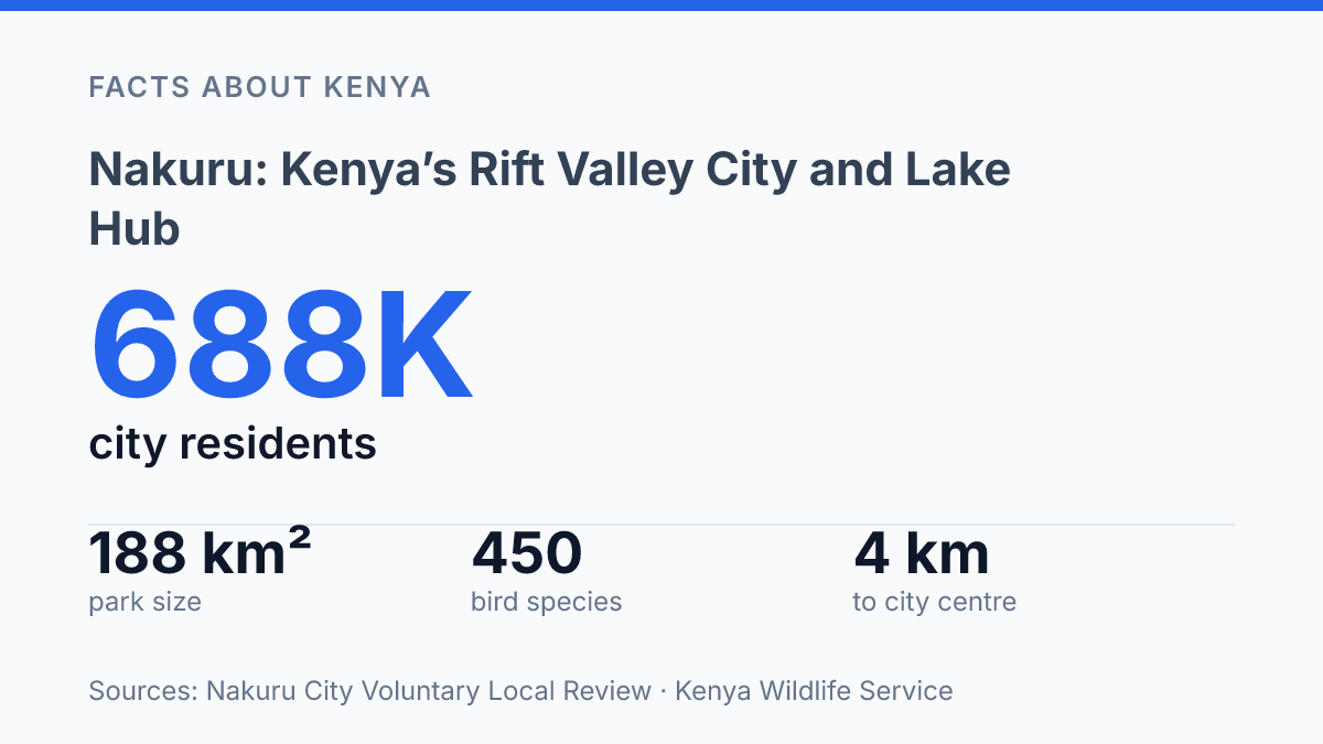
Nakuru became Kenya’s youngest city on 1 December 2021, but its national park gate sits just 4 km from the city it now has to grow around.
That is the tension that makes this Rift Valley hub more than a stop on the A104 from Nairobi. A city of 686,630 people is expanding beside alkaline water that can sit around pH 9–11.
The lake looks calm from above, yet its food chain can flip when water levels rise. That’s why flamingos may gather in pink sheets one season, then shift to other soda lakes the next.
The article follows that contrast: fast city, shallow soda lake, protected wildlife, and high viewpoints with real payoff. Lake Nakuru National Park is easy to reach. It isn’t simple. In my honest opinion, that complexity is exactly what makes the place worth understanding before you arrive.
Where Nakuru sits in Kenya
About 160 kilometres northwest of Nairobi, the county capital sits where Kenya’s highland roads begin to tip toward the west. It is the capital city of Nakuru County, Kenya, and its position in the Great Rift Valley gives it a role bigger than a dot on the map. You feel that role most on the road.
The A104 corridor ties the city to Nairobi on one side and the western route toward places such as Eldoret, Kisumu, and Uganda on the other. That makes it useful for trade, commuting, bus travel, and weekend trips. It also explains why people who don’t plan to stay still pass through it.
The Nakuru City Voluntary Local Review says the municipality was elevated to city status by charter on 1 December 2021, and describes it as Kenya’s “youngest city.” The same review lists 686,630 people in a 308 sq. km city.
This is not a small town wearing a bigger title. Its growth has a practical edge: services cluster here because movement already flows through here.
The county around it is much larger. The County Integrated Development Plan 2023–2027 puts it at 7,504.9 km² in the central Rift, with just over half of residents living in urban areas in 2023. That matters, because the city anchors the county’s urban life rather than sitting apart from it.
The tradeoff is clear. In my view, the city’s location is its biggest advantage. It also means it gets judged as a stopover when it deserves more attention as a destination. Places on major routes can vanish behind the journey itself… and that is exactly the wrong way to read this Rift Valley hub.
Lake Nakuru’s soda water and flamingos
The lake’s famous pink fringe depends on microscopic algae more than on any permanent promise of flamingos. Lake Nakuru is an algae-filled soda lake, and its alkaline water creates the conditions that feed huge flocks when the chemistry lines up. In Kenyan Rift soda lakes, Pálmai et al. in Hydrobiologia report typical alkalinity of pH 9–11, a range that suits the cyanobacteria lesser flamingos filter from the water.
That food chain is brutally simple. Algae bloom, flamingos arrive. Algae crash, the birds leave.
Thousands can gather when the shallows are rich. The postcard version hides the moving parts behind the color.
Water level is the big complication. UNESCO’s 2011 nomination file describes the lake as only 3 metres deep at maximum. A rise or fall can change feeding conditions fast.
More water can dilute the concentrated soup that soda-lake birds depend on. Less water can expose feeding areas. It can also push salinity and chemistry beyond the sweet spot.
The shift isn’t theory. Pálmai et al. reported that the lake’s key flamingo food cyanobacterium collapsed in the early 2010s, forcing many lesser flamingos to move to other Rift lakes.
Byrne et al. in Current Biology later found that lesser flamingo distribution across 22 East African soda lakes from 1999 to 2022 tracked phytoplankton biomass most strongly. In plain terms: birds follow food, not reputation.
The stars are still the lesser flamingo, especially when the lake blushes pink along the margins. But the bird story is broader than that. Kenya Wildlife Service lists about 450 bird species in the protected area, so pelicans, cormorants, herons, storks, and other waterbirds also shape the lake’s daily rhythm.
In my honest opinion, the most honest way to see the lake is not as a guaranteed flamingo spectacle, but as a live ecological gauge. When the water, algae, and birds align, the effect is unforgettable. When they don’t, the absence tells you just as much.
Inside Lake Nakuru National Park
The park protects one of Kenya’s rare places where rhino viewing can feel almost immediate rather than like a full-day search. Lake Nakuru National Park is the main wildlife area around the lake, and Kenya Wildlife Service says it reached its current 188 km² size after a 1974 expansion. That compact scale changes the whole experience.
Rhinos anchor the park’s conservation story. KWS identifies it as Kenya’s first government-managed rhino sanctuary, created in 1987.
That status still shapes what visitors come hoping to see. White rhinos are the easier prize, grazing in open areas where vehicles can keep a respectful distance.
The bigger surprise is how much else fits around them. Rothschild’s giraffes browse above the acacias, lions rest in shade, and leopards stay harder to pin down.
You can see the big names here. The park doesn’t feel like a vast wilderness where sightings depend on endless driving.
In my humble opinion, the park’s biggest draw isn’t just the famous animals. It’s the chance to see them in a compact area. That also means visitors can expect crowds at the best viewing spots.
A lion near the track can turn a quiet drive into a queue in minutes. That’s the tradeoff.
Warthogs and baboons add a rougher, more ordinary kind of wildlife theatre near popular stopping points. Baboons watch cars with bold patience. Warthogs trot through grass with tails up, looking comic until you notice how alert they are.
Park rules matter here. Kenya Wildlife Service lists a 40 km/h speed limit and a 20-metre minimum distance from animals, and those numbers aren’t decorative. They protect the wildlife.
They also protect the mood of the place. Rush it. You miss the smaller dramas happening beside the road.
Best lookout points for views and photos
From the cliff edge, the lake stops looking like a shoreline attraction and starts reading like a map. Baboon Cliff gives you that shift fast: open water below, pale soda flats around the edge, and bird movement that makes more sense from height than it does from the road.
This is the classic place to frame the lake with flamingos when they’re present. You don’t just see pink birds. You see where they gather, thin out, and follow the shallows.
That matters for photos. It also helps you understand why the scene changes from one visit to the next.
The name isn’t decorative either. Baboons use the area confidently. That can be funny until it isn’t. In my view, this is where visitors should put the camera down for a minute and watch the whole ridge, not just the water.
Lion Hills gives a different kind of view. The lake still dominates.
The eye also catches movement on the land below: warthogs crossing open ground, baboons near the tracks, and mammals slipping between cover and grass. It feels less like a postcard and more like a working habitat.
The tradeoff is simple. The best views are not always the easiest to reach. That small effort pays off fast… you get the broadest read on the whole area from above, not at water level.
Down low, the lake can flatten into glare and reeds. From higher ground, its shape, color bands, and wildlife corridors become clear.
UNESCO’s 2011 nomination file names Lion Hill, Baboon Cliffs, and Out of Africa as established high-elevation viewpoints. The same file places the park’s terrain between 1,760 and 2,080 metres above sea level, which explains why these lookouts feel so open.
They’re not just photo stops. They’re the places where the lake, birds, cliffs, and animals finally connect in one view.
What the lake asks before you press the shutter
Treat the visit less like a checklist and more like a timing problem. Gates run from 6:00 AM to 6:00 PM. The best decision may happen before dawn: check recent lake levels, ask about flamingo movement, and choose your first viewpoint with the sun in mind.
Conservation adds another layer. The park became Kenya’s first government-managed rhino sanctuary in 1987. That history should change how you move through it.
Keep the 20-metre wildlife distance. Let animals own the road. If clouds build, Baboon Cliffs can still give you the wider story.
In my humble opinion, the smartest visitor doesn’t chase a perfect pink lake. They read the place as it is that morning, then leave room for it to surprise them.
Frequently Asked Questions
Q: What is Nakuru known for?
A: Nakuru is known for being the capital of Nakuru County and for its access to Lake Nakuru National Park. The park is a big draw because you can see rhinos, giraffes, lions, and leopards in one place. In my view, that mix of city base and wildlife access is exactly why the area stands out.
Q: How far is Nakuru from Nairobi?
A: Nakuru sits northwest of Nairobi in Kenya’s Great Rift Valley. The route is straightforward. The scenery changes fast once you leave the capital. That contrast is part of the appeal.
Q: Why do flamingos gather at Lake Nakuru?
A: Lake Nakuru is an algae-filled soda lake. That food source pulls in thousands of flamingos. The birds come for the lake. The setting gives you much more than just a birdwatching stop. You also get wide views and a real sense of the Rift Valley terrain.
Q: What animals can you see in Lake Nakuru National Park?
A: You can see rhinos, giraffes, lions, and leopards in Lake Nakuru National Park. Warthogs and baboons are also common around the lookout areas… and that makes the park feel busy in the best way. The wildlife mix is strong without feeling staged.
Q: Which viewpoints are best for seeing Lake Nakuru?
A: Baboon Cliff and Lion Hills are the main lookout points for views over the lake, birds, and nearby mammals. They’re the places to go if you want a broad look at the park instead of staying at ground level. In my honest opinion, Baboon Cliff gives the sharper first impression.