
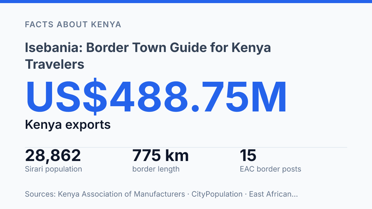
Isebania sits on a border that carried US$488.75 million in Kenyan exports to Tanzania in 2024. The first problem for travelers is surprisingly simple: the name. On the Kenya side, the official crossing is Isebania.
On the Tanzania side, it’s Sirari. The East African Community’s OSBP list made that pairing formal in 2016, but maps and travel sites still blur the line.
That blur isn’t harmless. Mapcarta places a Tanzanian residential area with the same name in Tarime District, at 1,503 meters elevation, while also flagging the Kenyan town. In my honest opinion, that’s the detail most border guides handle too casually. This guide clears up where the crossing sits, how it relates to Tarime and Musoma, and why the wording matters before you plan a route, book a ride, or explain your destination to an official.
Where the border town sits
A map search can put you on the wrong side of an international boundary by a few hundred metres here. The label looks simple. It sits on a border where one name can point to two neighboring places.
The Tanzanian-side town is in Tarime District, Mara Region, in northern Tanzania. It sits directly on the border with Kenya, just south of Isebania, Kenya.
That last detail matters: the name makes people think of one place. There are two border towns with the same name on opposite sides of the line.
Use 1°14’44.0″S, 34°28’32.0″E for the town’s mapped position. In decimal form, that is -1.245569, 34.475555. Those coordinates put the pin on the Tanzanian side, not across the border.
In 2026, Mapcarta/OpenStreetMap/GeoNames placed a Tanzanian residential area under this name in Nyamaranga, Tarime District Council, Mara, at -1.23783°, 34.4824° and 1,503 m elevation, while also flagging the same name as a town in Kenya. That split is the whole mapping problem in miniature. In my view, the border label matters more here than the settlement label, because one careless pin can move the place into the wrong country.
How far it is from Tarime and Musoma
The shorter road north from Tarime tells you who runs the area. The longer line back to Musoma tells you where it really sits on a traveler’s mental map.
From Tarime, the district headquarters, the border town is about 20 kilometres (12 mi) to the north. Rome2Rio puts the drive at 19.4 km and roughly 17 minutes, as of 2026. This is a short local link rather than a major overland haul.
That closeness matters. Tarime is the administrative anchor, the place tied to offices, district services, and local transport decisions. But it doesn’t give most outsiders a strong geographic fix.
Musoma does that better. The town lies about 92 kilometres (57 mi) northeast of Musoma, the nearest large regional town. DistancesFrom gives a road estimate of 93 km and about 1 hour 16 minutes, while Rome2Rio’s route estimate is longer at 101.7 km and about 1 hour 31 minutes.
Those figures don’t contradict each other as much as they show how road routing changes the answer. A straight description says 92 kilometres.
A driving app may stretch that once it follows the actual road. If you’re planning transport, use the road estimate, not just the headline distance.
Musoma also gives the clearest orientation point because it sits on the eastern shores of Lake Victoria. That single detail places the border town within the lake-facing side of Mara Region without turning the trip into a regional geography lesson. In my honest opinion, this Tarime-versus-Musoma split is the useful detail: one place explains administration. The other explains where you are.
Why the name causes confusion
The same place-name can send you to the wrong side of an international border before you realise the map is treating two settlements as one. Isebania is also spelled Isibania. That alternate spelling adds another layer to searches, tickets, and saved pins.
The Tanzanian town is directly south of Isebania, Kenya. That sounds tidy on paper. It creates real friction for visitors and researchers who expect one town and find two.
A bus agent may use the familiar Kenyan name. A map app may surface a Tanzanian result. A local direction may point you toward the crossing, not the exact settlement you had in mind.
Official naming doesn’t always match casual speech. The East African Community One Stop Border Posts Act, 2016, lists the Kenya-Tanzania paired crossing with the Kenyan-side name matched to Sirari on the Tanzania side.
The same Act names 15 common border posts across the region as one-stop border posts. The label matters in formal travel and trade documents.
That split explains why travel notes can look contradictory. Tanzania’s immigration list uses Sirari for the Mara road entry point, not the Kenyan-side name. Map sources and transport listings may still blur the area, especially when they aim to help ordinary travelers rather than follow government terminology.
For research, use the country name every time you search or compare sources. For travel, ask whether the stop is on the Kenya side, the Tanzania side, or at the border facility itself. In my humble opinion, that’s the simplest way to avoid a small naming issue becoming a missed connection.
What this border location means
The national line does more work here than the town grid: it decides whether people describe the same stop through Kenya, Tanzania, or the crossing between them.
That’s why the town functions less like an inland settlement and more like a boundary settlement between Tanzania and Kenya. Its location in Mara Region places it inside northern Tanzania’s border corridor, not just inside an administrative area on a map. In my view, border context explains this town better than any district label can.
For a Kenya traveler, a county-style label is the wrong mental model. Saying the town is “in Mara” is like saying Dover is “in Kent”: accurate, but less useful than saying it faces an international crossing.
The border is the practical reference point. It tells you why names shift, why directions sound inconsistent, and why people may talk about the area from either side of the line.
Small border towns can look minor on a map, but their position shapes everything… identity, trade, transport language, and how people explain where they’re going. The Kenya Association of Manufacturers reported in 2026 that the Kenya–Tanzania borderline runs for 775 km and has 6 official border posts. That puts this crossing into a wider system, not a local footnote.
The economic context proves the point. The same report said Kenyan exports to Tanzania reached US$488.75 million in 2024. Not all of that belongs to this single crossing, of course.
But the figure shows why these border points matter far beyond the nearest town sign. They sit where national geography becomes daily movement.
The name you write down matters at the barrier
Treat the crossing less like a dot on a map and more like a paired system. Before you travel, check your paperwork against the name used by the agency you’re dealing with.
Kenya may point you to the Kenyan side. Tanzania may point you to Sirari.
In 2026, that difference still matters. The Tanzanian side lists 24-hour road entry, but not every nearby road point keeps the same rhythm. That contrast can save you from bad timing.
In my humble opinion, the smart move is to write both names in your notes, not just the one your app displays. Borders punish vague language. A place name can be local, official, commercial, and wrong for your next form… all at once.
Frequently Asked Questions
Q: Is Isebania in Kenya or Tanzania?
A: Isebania, also called Isibania, is the Tanzanian border town in Tarime District, Mara Region. It sits directly south of Isebania, Kenya. The two names get mixed up a lot. 1°14’44.0″S is the key clue if you’re checking a map.
Q: How far is Isebania from Tarime?
A: It’s about 20 kilometres north of Tarime. That’s close enough for a quick transfer. It still takes planning if you’re crossing with bags or dealing with border traffic. Tarime is the district headquarters, so it’s the place many travelers use for services.
Q: How far is Isebania from Musoma?
A: Isebania is about 92 kilometres northeast of Musoma. Musoma is the nearest large town on the eastern shores of Lake Victoria, so it’s the bigger reference point for travel planning. The trip sounds straightforward, but road conditions and border delays can change that fast.
Q: What are the coordinates of Isebania Tanzania?
A: The town’s coordinates are 1°14’44.0″S, 34°28’32.0″E. If your navigation app shows a different spot, check whether it’s pulling the Kenyan side by mistake. That mix-up happens more than it should.
Q: Why do people confuse Isebania and Isibania?
A: Because both names point to the same border area on the Tanzania-Kenya line. The spelling changes by side. The Tanzanian town is in Mara Region. The Kenyan town sits just across the border. In my view, that’s the detail travelers should verify first, not last.